![]()
|
|
|
|
|
| Home | NPP Products | LIDAR | Frequently Asked Questions |
| Site Map | Land / Ocean Merge | Field / Lab Data | Highlights / Results |
![]()
|
|
|||||||||||
|
|||||||||||
|
|
|||||||||||
Please note:
The Ocean Productivity Site has stopped updating its data.
|
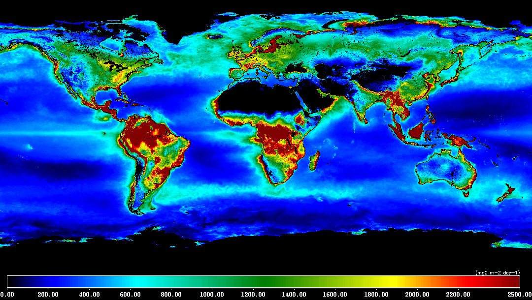
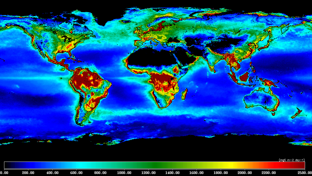
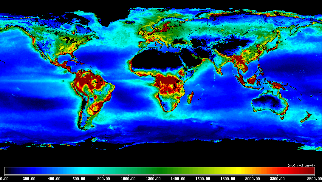
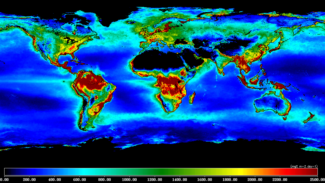
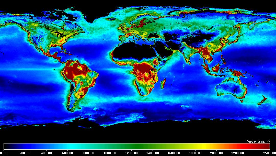
Online Data: Land / Ocean NPP Merge
2160 by 4320 (9 km) Yearly HDF files using:
|
||||||||||||||||||||||||
Data Selectionhdf file naming conventionnpp.yyyy.hdfnpp = net primary production (units of mg C / m**2 / day) yyyy = year hdf = file type files have not been compressed The hdf files have metadata contained within them, which can be examined, for example, with program "ncdump". terrestrial npp is based on the 0.05 degree aggregated improved Collection 5.1 annual MOD17A3 npp output from the Numerical Terradynamic Simulation Group (NTSG) at the University of Montana; oceanic npp is based on the standard vgpm, using seawifs chl, avhrr sst, and seawifs par as input; oceanic clouds have been filled in the input data using our own gap-filling software. For citation, please reference Zhao et al, 2005 for terrestrial npp information, the original vgpm paper by Behrenfeld and Falkowski, 1997a for the oceanic npp model, as well as the Ocean Productivity site for the data. Yearly Files
|
|
|
|